Browsers are
difficult
Please wait, loading your map...
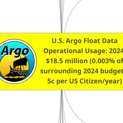
U.S. Argo Float Data
Operational Usage: 2024:
$18.5 million (0.003% of
surrounding 2024 budgets;
5c per US Citizen/year)
U.S. Navy and
other naval
forces - 2024:
$255.8 billion
U.S. Coast
Guard (USCG)
and other
maritime
agencies - 2024:
$13.9 billion
U.S. Army
and other
army forces
- 2024:
$185.5
billion
Oil and Gas
Industry - 2024
Payroll = $168
billion; Federal
Revenue = $13
billion
Submarine and Anti-
Submarine Warfare (ASW)
Naval Operations &
Mission Planning
Ocean & Weather
Forecasting
Mine Warfare
Research &
Development
Acoustic Propagation Modeling: Argo data improves sonar performance predictions by providing
real-time temperature and salinity profiles, which affect how sound travels underwater.
Thermocline Detection: Knowing the depth of the thermocline
helps submarines hide from and detect enemy vessels.
Navigation & Safety: Helps surface ships and submarines avoid hazardous oceanographic conditions.
Route Optimization: Supports efficient fuel usage and speed adjustments based on ocean currents and water density variations.
Improved Weather Models: Enhances long-range forecasts for naval missions and fleet movements.
Hurricane Prediction: Assists in predicting storm intensity and paths, aiding in fleet protection.
Underwater Mine Detection: Helps determine how water properties affect the performance of sensors used for detecting naval mines.
Oceanographic Studies: Supports military oceanography programs to understand global ocean dynamics.
Arctic & Deep-Sea Operations: Helps in strategic planning for operations in changing environments, such as the Arctic.
Search and Rescue (SAR)
Operations
Maritime Safety &
Navigation
Environmental
Protection & Pollution
Response
Weather and Storm
Forecasting
Fisheries Enforcement &
Marine Conservation
Arctic and Deep-Water
Operations
Improved Ocean Current Models: Argo data enhances ocean current predictions, which helps determine where missing boats, shipwreck debris, or people in the water may drift.
Survivability Estimates: Temperature and salinity data help assess hypothermia risks for individuals lost at sea.
Hazard Avoidance: Argo data helps predict dangerous conditions like rogue waves, strong currents, and shifting thermal layers.
Iceberg and Sea Ice Monitoring: Assists in Arctic and Antarctic operations by tracking changes in ocean temperature that influence ice formation.
Oil Spill Tracking: Helps predict the movement of oil spills based on ocean currents and temperature gradients.
Chemical and Hazardous Spill Response: Supports modeling the dispersion of pollutants in the ocean.
Hurricane and Storm Surge Prediction: Argo data helps improve forecasts of severe weather that impact coastal communities and maritime operations.
Tsunami Monitoring: While not directly a tsunami detection system, Argo data contributes to models that predict sea level changes.
Illegal Fishing Detection: Supports efforts to track and regulate fishing in protected zones by understanding ocean conditions that attract certain species.
Marine Ecosystem Monitoring: Helps monitor changes in ocean health, including temperature shifts that affect fish populations.
Cold-Water Rescue & Patrols: Assists in planning Coast Guard operations in colder regions by tracking sea ice and water temperature changes.
Maritime Domain Awareness: Supports broader ocean surveillance for national security and law enforcement.
Environmental and
Terrain Assessments
Logistics and
Deployment
Strategic Operations
Naval Integration: In joint operations with the Navy or Coast Guard, the Army may use Argo data to support
collaborative efforts that require detailed knowledge of ocean conditions for tactical and strategic advantage.
Route Planning: For amphibious operations or logistics support involving naval transportation, Argo data can
help predict sea conditions, such as currents and temperature variations, that affect shipping routes and timing.
Resupply Missions: In remote or harsh environments, understanding ocean conditions can aid the
planning of resupply routes across water, ensuring the safety and efficiency of military transport.
Flooding and Hydrology: Argo data can contribute to understanding oceanographic conditions that influence sea
level rise, coastal flooding or storm surge, which may affect military installations and operations.
Environmental Monitoring: For long-term planning, the Army may use Argo data to understand shifting ocean
temperatures, which can have indirect impacts on global and regional security concerns related to environmental changes.
Environmental
Monitoring
Improving Seismic Data
Accuracy
Oil Spill Response
Understanding Ocean
Currents for Offshore
Operations
Carbon Capture and
Storage (CCS)
Monitoring
Monitoring Underwater
Infrastructure
Argo floats can help monitor ocean conditions around offshore drilling sites, ensuring that operators can detect any sudden changes in water temperature,
salinity, or currents. This information is crucial for managing and minimizing environmental risks, such as potential oil spills or changes to marine ecosystems.
The oil and gas industry relies heavily on seismic data to explore potential drilling locations. Argo floats can enhance seismic monitoring by providing
a better understanding of ocean conditions that affect the propagation of seismic waves, thus improving the accuracy of subsurface mapping.
In case of an oil spill, knowing ocean currents, temperatures, and salinity patterns is essential for predicting the movement and spread
of the spill. Argo floats can provide real-time data to assist in these predictions, which aids in more effective response strategies.
Offshore oil and gas operations, including drilling and transportation, are impacted by ocean currents and other marine conditions. Argo floats
provide continuous data on these variables, which can be used to improve safety and operational efficiency, particularly in remote locations.
The oil and gas industry is also exploring carbon capture and storage techniques to reduce greenhouse gas emissions. Argo floats can be used to
monitor the ocean’s physical and chemical properties in areas where CO2 is being stored, ensuring that the gas is sequestered safely and doesn’t leak.
For subsea pipelines or other underwater infrastructure, understanding the conditions in the water column and the seabed is
critical. Argo floats can help track temperature and salinity variations that might affect the integrity of these structures over time.
Deep Argo floats can also detect the ocean floor, making the bathymetry near pipelines better undersood.
The North American Multi-
Model Ensemble (NMME)
The NMME is a seasonal prediction system that combines
forecast information from state-of-the-art computer
climate models currently running in the U.S. and Canada
Data.gov - The contributing modeling centers are NOAA's National Centers for Environmental Prediction (NCEP),
NOAA's Geophysical Fluid Dynamics Laboratory (GFDL), NASA's Goddard Space Flight Center (GSFC), Canadian Centre
for Climate Modelling and Analysis (CCCma), and the National Center for Atmospheric Research (NCAR).
NCEI provides access to data for global, 12-month forecasts of 13 key variables. NMME data is daily or 6-
hourly with a 1º by 1º spatial resolution. Most NMME datasets have 10 realizations for each variable.
The University of Miami hosts the NMME products that are used by many U.S.-based and international entities, both private and
public, for regional or otherwise tailored weather and ocean forecasts. Argo floats are an essential data source for the NMME.
Federal
Aviation
Administration
(FAA) - 2024:
$24.8 billion
Aviation Weather
Monitoring
The FAA may use oceanic data (including from Argo floats) for forecasting tropical cyclone paths and
intensities, which can significantly impact aviation safety in areas affected by storms and hurricanes.
Real-Time
Oceanographic
Monitoring
Argo floats provide continuous, real-time data on ocean temperature, salinity, and currents, which are
integrated into operational models for weather forecasting, maritime operations, and climate monitoring.
Short-Term Forecasting
By feeding Argo data into forecasting models, agencies can predict ocean conditions (such as
water temperatures and currents) that influence short-term weather and environmental
conditions. This is particularly important for coastal areas and marine environments.
Marine Safety
Real-time ocean conditions (temperature, salinity, currents) support operational search and rescue, shipping
routes, and fishing regulations, by ensuring safe conditions and predicting dangerous changes in ocean conditions.
Operational Decision-
Making
Argo data feeds into decision-making systems that require accurate ocean conditions,
such as in the military, coastal disaster management, or marine conservation.
NOAA National
Hurricane
Center - 2024:
$41.9 million
Validate and Refine
Hurricane Forecasts
Evaluate and calibrate ocean current models, which
improves predictions of hurricane paths and intensities.
Utilize Argo floats to improve our understanding of oceanic
conditions that influence storm development and behavior.
National
Aeronautics
and Space
Administration
(NASA) - 2024
$24.875 billion
Operational Earth
Science Missions
NASA integrates Argo data into its Earth Science operational models to improve satellite calibration and real-time monitoring
of ocean conditions. The data supports missions that focus on the Earth’s climate and its changing environmental patterns.
Weather Prediction
Models
NASA uses Argo data to enhance the accuracy of its operational models that predict weather patterns, especially those influenced by
ocean conditions. For example, data on sea surface temperature can inform models for predicting El Niño and La Niña events.
Sea-Level Rise and Heat
Content Monitoring
NASA relies on Argo data to track ocean heat content, an important factor in global warming. This data, combined
with satellite altimeter measurements, helps in calculating sea-level rise and understanding its impact.
Improving Remote
Sensing Calibration
NASA also uses Argo data to validate satellite measurements, such as sea surface
temperature and salinity readings from its ocean-observing satellites like the Aqua satellite.
U.S. Geological
Survey (USGS) -
2024: $1.6
billion
Environmental
Monitoring and Impact
Assessments
The USGS uses real-time Argo data to monitor ocean conditions in support of operational
assessments related to sea level rise and coastal ecosystem health. This data is critical for assessing
the ongoing environmental impact of climate change on U.S. coastlines and maritime zones.
Operational Hazard
Response
Argo data is valuable for operational responses to oceanographic hazards like tsunamis, coastal flooding,
or large-scale environmental changes that could affect infrastructure, natural resources, or ecosystems.
Marine Tourism
and Recreation
- 2021: $232
billion
Ocean Condition Monitoring
Argo floats provide near real-time and historical data on sea temperature (at various depths), salinity, currents,
and thermocline depth for using in ocean models. These models helps diving operators choose optimal dive sites
and times based on water clarity and temperature. Snorkeling tours avoid thermocline zones that might affect
visibility and comfort. Fishing charters locate favorable temperature fronts or currents that attract target species.
Improved Safety
Argo data enhances ocean forecasts used by weather and marine services. It helps model rip current risks,
storm surge, or offshore conditions, assisting small boat operators and tour services in planning safe trips.
Coral Reef and
Ecosystem Health
Argo data contributes to climate models and regional monitoring that help assess sea temperature trends and potential bleaching
events. This supports eco-tourism and marine park management by helping protect key tourist attractions like coral reefs.
Climate and Seasonal Planning
Seasonal temperature forecasts, made better with Argo inputs, help businesses plan for peak
tourism periods, adjusting schedules or marketing based on predicted favorable ocean conditions.
Education and Citizen Science
Argo data is often integrated into educational tours, museum exhibits, or interactive
apps, giving tourists a better understanding of ocean science and conservation.
Link to International
Operational Centre Usage
United States
Department of
Agriculture
(USDA) - 2024:
$203 billion
Weather Monitoring
and Modeling
Argo floats provide critical ocean data—especially on temperature,
salinity, and ocean currents—which feed into global weather models.
The USDA uses weather models to forecast conditions that affect agriculture, such as
drought, rainfall, and temperature patterns. Improved ocean data leads to more accurate
seasonal forecasts, which the USDA uses in crop yield estimates and food security planning.
Drought and Soil Moisture Monitoring:
US Drought Monitor Product
Ocean conditions (like El Niño/La Niña)
influence U.S. drought patterns.
Argo data helps track these ocean phenomena, which are inputs for tools like the U.S.
Drought Monitor—a key USDA decision-support system for disaster relief and planning.
Research Partnerships
USDA collaborates with NOAA, NASA, and other agencies that do use Argo data more
directly. Through these partnerships, USDA research benefits from better environmental
datasets when studying climate impacts on agriculture, fisheries, and forestry.
Food Security and
Global Monitoring
USDA monitors international agricultural production and global food supply
chains. Ocean data from Argo helps monitor climate conditions in other parts of
the world, contributing to global food security assessments, especially in regions
where agriculture is sensitive to monsoons or ocean-driven climate cycles.
Crop Assessments, yield
estimates and food
security planning.
The USDA uses weather models to forecast conditions that affect agriculture, such as
drought, rainfall, and temperature patterns. Improved ocean data leads to more accurate
seasonal forecasts, which the USDA uses in crop yield estimates and food security planning.
Argo floats measure ocean productivity, such as net primary production (NPP), which is influenced by ocean conditions like nutrient
availability and light. These factors can affect atmospheric moisture and precipitation patterns, impacting agricultural productivity.
For example, a study using BGC Argo floats provided year-round NPP estimates in the western North Atlantic, highlighting how
ocean conditions influence atmospheric patterns that can affect crop yields. The USDA integrates this oceanic data into crop models
to assess potential impacts on crop production, particularly in regions sensitive to ocean-driven climate variations.
USDA’s National
Agricultural Statistics
Service (NASS)
NASS uses Argo data for modeling and forecasting agricultural
trends influenced by oceanic and atmospheric conditions.
NOAA National
Weather
Service (NWS) -
2024: $1.357
billion as part
of NOAA budget
Real-Time Weather
Forecasting
The NWS uses Argo float data to improve the accuracy of ocean-atmosphere
interaction models. This data helps enhance short-term weather forecasts,
especially for regions influenced by ocean currents and sea surface temperatures
Marine and Coastal
Forecasts
Argo data supports marine weather forecasting, including predicting conditions
for shipping, fishing, and recreational boating. This information is crucial for
issuing advisories and warnings for maritime operations in coastal zones
Severe Weather
Prediction
Argo float data, particularly near real time ocean temperature, is vital for improving
forecasting capabilities for tropical storms, cyclones, and other ocean-driven weather events.
National
Oceanic and
Atmospheric
Administration
(NOAA) - 2024:
$6.72 billion
Operational
Oceanography and
Forecasting
NOAA integrates Argo data into its Global Data Assimilation System (GDAS), which combines observational
data into forecast models. This improves forecasts of ocean conditions, including sea surface temperatures
and subsurface currents, which are vital for short-term weather forecasts, particularly in coastal areas.
Hurricane and Storm
Surge Forecasting
Argo data contributes to hurricane prediction models by providing accurate, real-time information
on ocean heat content and currents, which are critical for forecasting storm intensity. The data
helps assess conditions conducive to hurricane development and predict storm surge impacts
Marine Safety and
Navigation
Argo data aids in predicting ocean currents and water temperature conditions for maritime
safety. This is important for shipping, search-and-rescue operations, and coastal management.
NOAA OAR ORF
U.S. National Ice
Center (US NIC) -
2024: part of
OAR's ORF $675.3
million budget
Arctic and Antarctic
Monitoring
The National Ice Center uses Argo float data to monitor temperature and salinity profiles in polar regions. This
information is vital for understanding changes in sea ice conditions, as ocean warming plays a crucial role in ice melt.
Sea Ice Prediction
Argo data, along with other satellite data, helps the NIC in forecasting sea ice conditions,
which is vital for navigation, safety, and environmental monitoring in the Arctic and Antarctic.
Shipping
Industry - 2024:
$12.5 billion
globally
Route Optimization
Temperature and salinity profiles help oceanographers model currents, eddies, and ocean fronts. These data are integrated
into marine forecast models (like HYCOM and CMEMS), which shipping companies use to lower emissions and reduce costs by:
- Avoiding strong head currents that increase fuel consumption.
- Using favorable currents to save fuel and time.
Weather and Ocean
Forecasting
Argo data enhances numerical weather prediction (NWP) models and ocean circulation models. This helps ships:
- Avoid severe weather systems like cyclones or rough seas.
- Navigate more safely in open ocean routes.
Environmental
Compliance
Argo data is critical for climate monitoring, including ocean heat content and deoxygenation. This supports regulatory
efforts and emissions tracking under frameworks like:
- The International Maritime Organization’s Initial Strategy on the Reduction of Greenhouse Gas (GHG) Emissions from Ships.
- Ballast water management, where understanding salinity layers helps assess ecological risk.
Port and Coastal
Operations
Coastal adaptations of Argo (e.g. Bio-Argo floats or T/S profiling floats) help model coastal current systems, informing:
- Safer port approaches.
- Efficient tugboat deployment and docking in challenging currents.
Support for Emerging Tech
Autonomous vessels and route planning systems use real-time ocean data for adaptive navigation.
Argo floats contribute to data lakes used in training AI routing algorithms.
Link to Argo and the
Modelling Community
×
Created using
MindMup.com